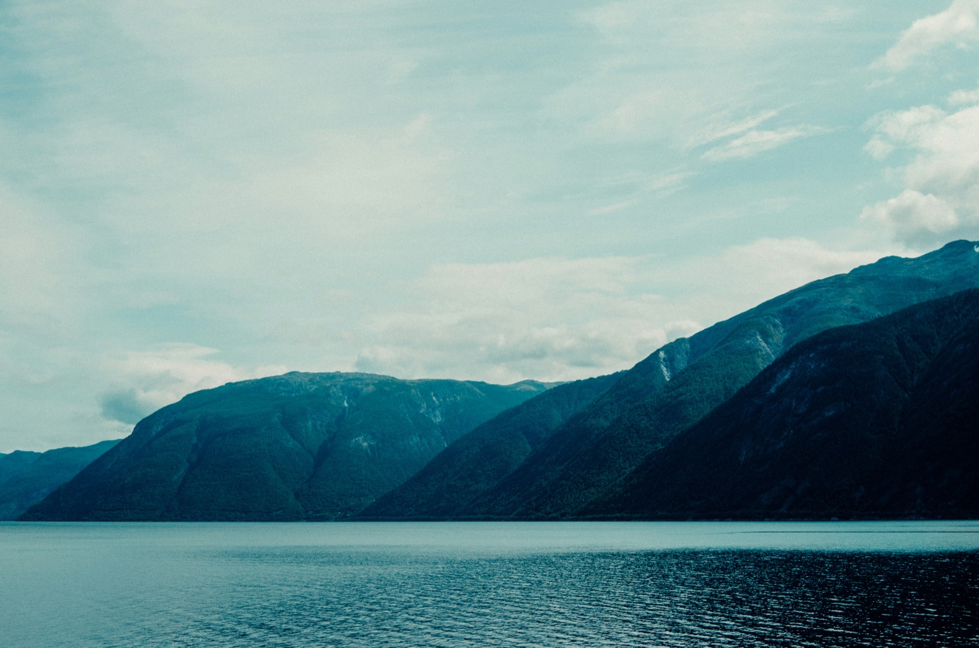
Most travel guides to the Sognefjord treat Høyanger as a dot on the map between better-known names — Flåm, Balestrand, Lærdal. That assessment undersells it significantly. Høyanger is a small industrial town sitting at the inner end of the Høyangsfjord, a southern branch of the Sognefjord, with mountains that rise sharply from the waterfront, waterfalls running through the town centre, and hiking routes that reach elevations you cannot access from most fjord villages. It is also the base for Sognefjorden Hiking Tours, which puts us in a reasonable position to tell you what is actually worth your time here.
Getting to Høyanger
Høyanger sits off the main E39/E16 tourist circuit, which is partly what keeps it quiet.
By car from Bergen: Drive east on the E16 and take the Hella–Vangsnes or Hella–Dragsvik ferry across the Sognefjord. From Hella, Høyanger is around 30 minutes south. Total from Bergen: approximately 2.5 hours including ferry time. Ferries run frequently in summer — check Skyss for the current timetable.
By car from Flåm or Lærdal: Head west along the Sognefjord via the RV55 or local ferry connections. The route takes 1–1.5 hours depending on your starting point.
By express boat: Norled operates express boat services connecting Høyanger with Bergen and several fjord villages. The journey from Bergen takes around 3.5 hours, and the views along the way are genuinely part of the experience. Check the Norled website for current departure times.
There is no train station in Høyanger. Parking is available near the ferry terminal and along the main street.
Hiking — the main reason to come
The mountains directly above Høyanger are the town's most significant asset, and they remain largely unknown outside the local community. Four marked routes operate from the town, covering a full range of difficulty levels.
Fossestien — The Waterfall Path runs through old farming terrain to a series of waterfalls above the town. 8 km return, around 400 m elevation gain, suitable for all abilities. The waterfalls are at their most forceful in late spring when snowmelt is still feeding them from above.
Bergefjellet climbs to 960 m for a panoramic view across multiple arms of the Sognefjord, with the mountains of Jotunheimen visible on clear days. 12 km return, moderately challenging, and the summit is one of the better viewpoints accessible to non-specialist hikers in the region.
Kraftruta — The Power Route is a demanding full-day route that combines serious ridge walking with the industrial heritage of Høyanger's early hydropower era — tunnels, old infrastructure, and genuine mountain terrain up to 1,100 m. 16 km return. Not for beginners.
Solrenningen reaches the highest point in the immediate area at 1,380 m. A long, physically demanding day with views across Sunnfjord and deep into the fjord system. Experienced hikers in good conditions only.
All four routes are guided privately — just your group, your guide, and your pace. No strangers, no fixed timetables.
The town itself
Høyanger was built almost entirely around aluminium production. The Hydro smelter, which has operated here since 1917 and still runs today, shaped the town's layout, architecture and community identity in ways that are immediately apparent when you walk around. This is not a chocolate-box Norwegian village. It is a working industrial town with genuine, unselfconscious character — and that is part of what makes it interesting.
Things worth seeing in town:
- Høyanger Industriarbeidermuseum — a focused museum covering the town's industrial and labour history. Well put together, honest about the reality of smelter work, worth an hour of your time
- The town waterfalls — two significant waterfalls pass through Høyanger itself, clearly visible from the main street. In spring and early summer they are loud enough to hear from a distance
- The fjord waterfront — a short walk from the centre, with views back across the Høyangsfjord to the mountains on the opposite shore
- The early 20th-century workers' housing — built by the aluminium company for its workforce, these streets give Høyanger a distinctive planned-town quality unlike other Sognefjord villages
The town has a grocery store, petrol station, bakery and a handful of cafes and places to eat. Høyanger is not a destination for fine dining, but it has everything you need as a hiking base.
Day trips from Høyanger
With a car, several worthwhile places are within an hour:
- Balestrand (45 min by car and ferry) — one of the most scenically positioned villages on the Sognefjord, with good accommodation options and easy access to the main fjord arm
- Vik i Sogn (30 min) — home to Hopperstad Stave Church, one of the best-preserved stave churches in Norway. A genuine detour worth making
- Fjærland (1 hr) — a small fjord village at the end of the Fjærlandsfjord, with glacier views and a well-regarded book town (antikvariat) that draws visitors throughout the summer
- Dale i Sunnfjord (40 min) — a larger town with better shopping and services if you need supplies for a longer stay
When to visit
The hiking season runs from late May to early October. July and August offer the longest days and the most reliable weather, but the shoulder months have real advantages: fewer other visitors, lower accommodation prices, and — from mid-September onwards — autumn colour on the lower trails. Snow can persist on Kraftruta and Solrenningen into June; your guide will advise on current conditions before you set out.
If you are coming specifically to hike, June is arguably the ideal month: the waterfalls are running hard, the days are exceptionally long, and you will have the routes largely to yourself.
Explore Høyanger's mountains with a local guide
Four private guided hiking routes above Høyanger — from the easy waterfall path to the 1,380 m summit of Solrenningen. Every tour is exclusively for your group, at your pace, on your chosen date.
See all hiking toursFrequently asked questions
How do you get to Høyanger, Norway?
By car from Bergen, drive east on the E16 and take the Hella–Vangsnes or Hella–Dragsvik ferry across the Sognefjord. From Hella, Høyanger is around 30 minutes south — total from Bergen is roughly 2.5 hours including ferry. Norled express boats also connect Høyanger with Bergen, with the journey taking around 3.5 hours. There is no train station in Høyanger.
Is Høyanger worth visiting?
Yes, particularly for hikers and travellers looking to experience the Sognefjord away from the main tourist flow. The mountains directly above the town reach over 1,300 m and offer some of the most accessible high-altitude hiking on the western Sognefjord. The town itself has a distinctive industrial character, waterfalls running through the centre, and a small but interesting museum covering its aluminium and hydropower history.
What hiking trails are there in Høyanger?
Four main routes operate above Høyanger: Fossestien (easy, waterfall trail, 8 km return), Bergefjellet (moderate, 960 m summit with Sognefjord panorama, 12 km return), Kraftruta (challenging, hydropower heritage route, 1,100 m elevation, 16 km return), and Solrenningen (demanding, 1,380 m summit, experienced hikers only). All four can be hiked with a private guide from Sognefjorden Hiking Tours.
Where can I stay in Høyanger?
Høyanger has limited but functional accommodation including a hotel and rental options in the area. For a wider choice, Balestrand (around 45 minutes by car and ferry) has good guesthouses and hotels on the Sognefjord. Many visitors use Høyanger as a day trip from Balestrand or other fjord villages, particularly if they are combining hiking with broader Sognefjord exploration.
What is Høyanger known for?
Høyanger is known primarily for aluminium production. The Hydro smelter has operated here since 1917 and still runs today — it shaped the town's layout, architecture and community identity. For visitors, the hiking terrain above the town and its position on the inner Sognefjord are the main draws.
When is the best time to visit Høyanger for hiking?
The hiking season runs from late May to early October. July and August offer the longest days and most reliable weather. June is a particularly good month — the waterfalls are running at full force, the days are very long, and crowds are minimal. Snow can persist on the higher routes into June; your guide will advise on conditions before you set out.